Digital twin technology has gained leading reliability engineers’ attention in recent years. Its ability to model asset lifecycles and simulate failure modes offers a shot in the arm to predictive maintenance. As with many emerging technologies, however, creating a fully-functional digital model can be a complicated project involving spatial mapping, IoT, artificial intelligence, analytics, and volumes of machine data.
NavVis, a software provider based in Munich, Germany, has blazed a slightly different path with its digital twin factory application. By integrating with a computerized maintenance management system (CMMS), its solution can digitally map an entire factory down to individual assets. It even has a 3D view via the CMMS software, supporting a range of maintenance workflow and management tasks.
In a December 2020 webinar for Fluke Reliability, NavVis technologists Emad Jooghi and Sebastian Schuster, plus Conner Rivard of Fluke Reliability’s eMaint division, described the new offering as “spatial Intelligence inside eMaint.”
“Spatial intelligence is the human ability to visualize shapes with the mind’s eye,” Rivard says. “Reality capture technology creates a digital version of that mind’s eye view so that we can access places without physically being there.”
How these systems work
NavVis mobile mapping systems, depicted in Figure 1, enable surveyors to map the surrounding environment continuously. The systems use wheel-based “trolly” imagers or wearable devices to take thousands of high-resolution 360-degree images and map millions of data points into “point clouds.”
The surveying and creation of the digital building twin are typically performed by NavVis service partners and updated annually.
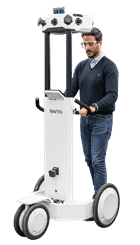

Figure 1: The NavVis M6 mobile mapping system on wheels (left) and the NavVis VLX wearable mapping device capture surroundings at walking speed.
Figure 2 below demonstrates the raw output. Point clouds are used in BIM (Building Information Modeling) models and CAD (Computer-Aided Design) drawings. Navigate the geotagged visual imagery from within the browser-based NavVis IndoorViewer software—or eMaint CMMS. Watch a demonstration in the webinar to see how the navigation works.
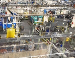
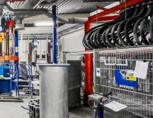
Figure 2. NavVis mobile mapping captures 360-degree images (left) and digital point clouds (right).
NavVis spatial intelligence maps fully integrate into eMaint CMMS software. They create a digital hub for maintenance operations capable of synchronizing condition monitoring data sources, asset management information, 360-degree digital imagery, and geolocation and maintenance work orders, all in one flow. The NavVis resource creates 2D and 3D visual repositories supporting the operational data, with critical assets tagged as “points of interest” within the digital map.
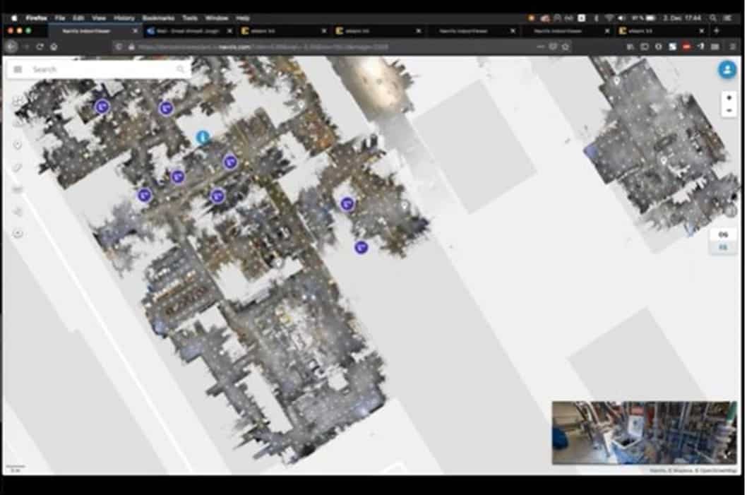
Figure 3. 2D representations of the factory floor calling out work orders and critical assets as points of interest
Says Jooghi, “We have connected the eMaint information directly with NavVis Indoor Viewer. By clicking on a digital point of interest within NavVis, you can look at all the information recorded about that machine within eMaint. You can also create a new work order, using your eMaint work order templates, or enable other workflows.” See Figure 4 for examples.
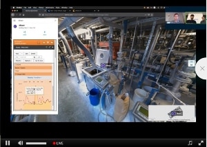
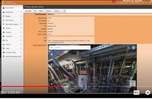
Figure 4. The NavVis-eMaint integration allows users to access condition monitoring data from the CMMS from within the NavVis viewer (left) and to include digital mapping information from within the work order (right)
Interactive asset mapping supports maintenance workflows in several ways, including:
- Linking contextual visual specifics to work orders that help technicians specifically identify the asset or component requiring attention
- Adding a separate source for asset geolocation for facilities with insufficient cellular service to support regular GPS
- Streamlining the asset cataloging and tagging process
- Creating work orders from the shop floor using a digital point of interest
- Reviewing the 2D map of the shop floor to see the status and location of critical assets and work orders
- Digitally measuring the distance between any two points in the facility without being there
- Enhancing the visual access of the shop floor across multi-site operations
- Allowing offsite contractors to visually review work conditions and prepare the job before entry
Work orders created from the shop floor using the mobile app can directly integrate the NavVis digital asset imagery and geolocation into the eMaint work order.
“The app is not only a tool to retrieve information on assets, but you can also use it to add information to the system,” Schuster notes. “We are trying to bring all of the digital information you have about your factory and assets closer together with the visual representation, in a fluid process.”
When polled, the audience attending the webinar prioritized assisting technicians with identifying the correct asset as the most beneficial aspect of the digital mapping capabilities of NavVis and eMaint. Many were also interested in conducting virtual visits and geotagging assets.
For more about digital twins, spatial intelligence, and the NavVis-eMaint solution, watch the webinar online or visit www.navvis.com.
